Live With Water
2030 Vision for Shangpai Town, Hefei
The 2030 Vision for Shangpai Town is a pilot project for the my Master’s Thesis at TU Delft, the full report is available at TU Delft repository.
Institution: TU Delft
Graduation Lab: Urban Metabolism and Climate
Time: Feb.2022 - Jun. 2022
Project supervisors: Kristel Aalber, Remon Rooij
Project location: Hefei, Anhui, China
Problem Statement
The Lake Chao Basin has witnessed rapid urbanisation in the past few dacades. Despite the rise of people’s overall living standard and local economy, this has led to increasing water issues in the area. The sprawling urban territory has largely occupied the originally unpaved surface and slowed down the natural infiltration process extremely, resulting in the growing flood risk in front of the extreme storm events. The emissions from the expanding urban area also bring severe contaminations to the water body within the basin. This not only leads to the degradation of the local ecosystem but also makes the water of Lake Chao hardly suitable for consumption since 2007, which put extra pressure on the local drinking water supply. Additionally, with the increasing intensity and frequency of drought and flooding in this area since the 20th century (CMA, 2021; Jia,2012). Further stress on water issues is foreseeable under the threat of global climate change. That is why it is essential for the area to reconsider how people live with water in a sustainable way in the future.
Methodology
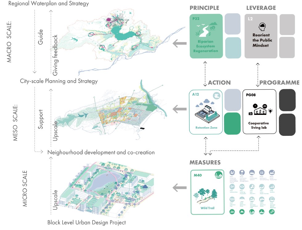
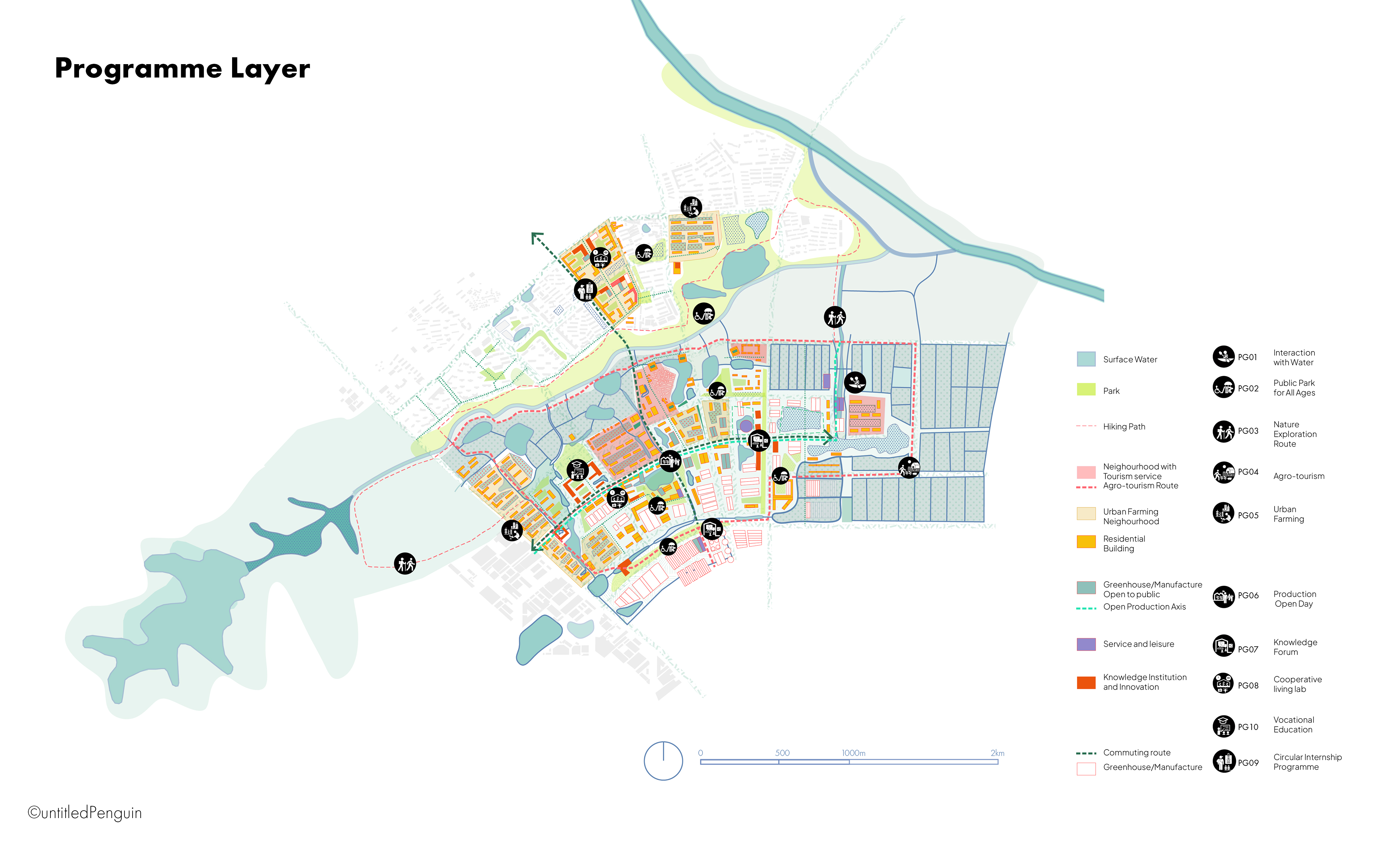
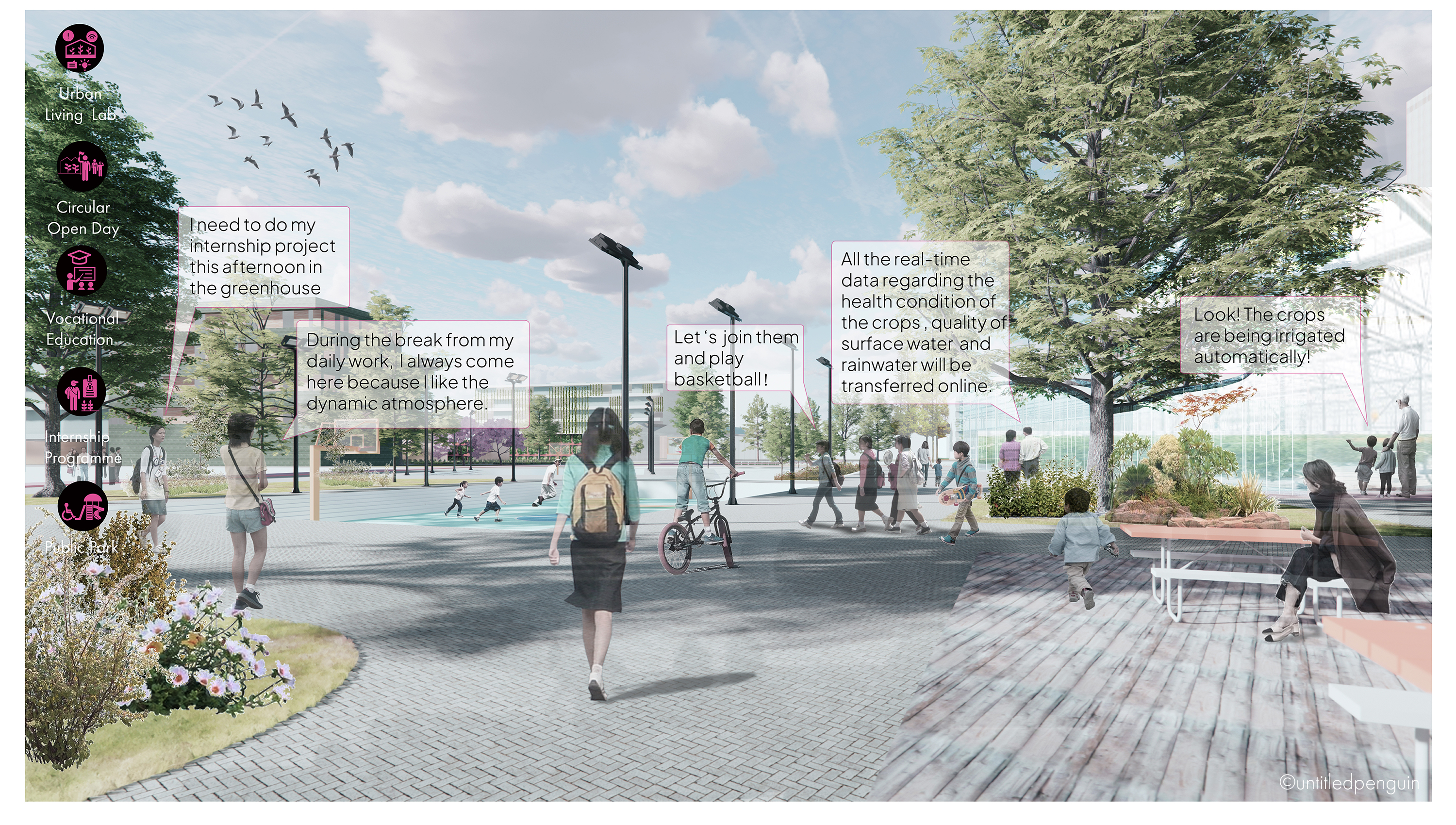
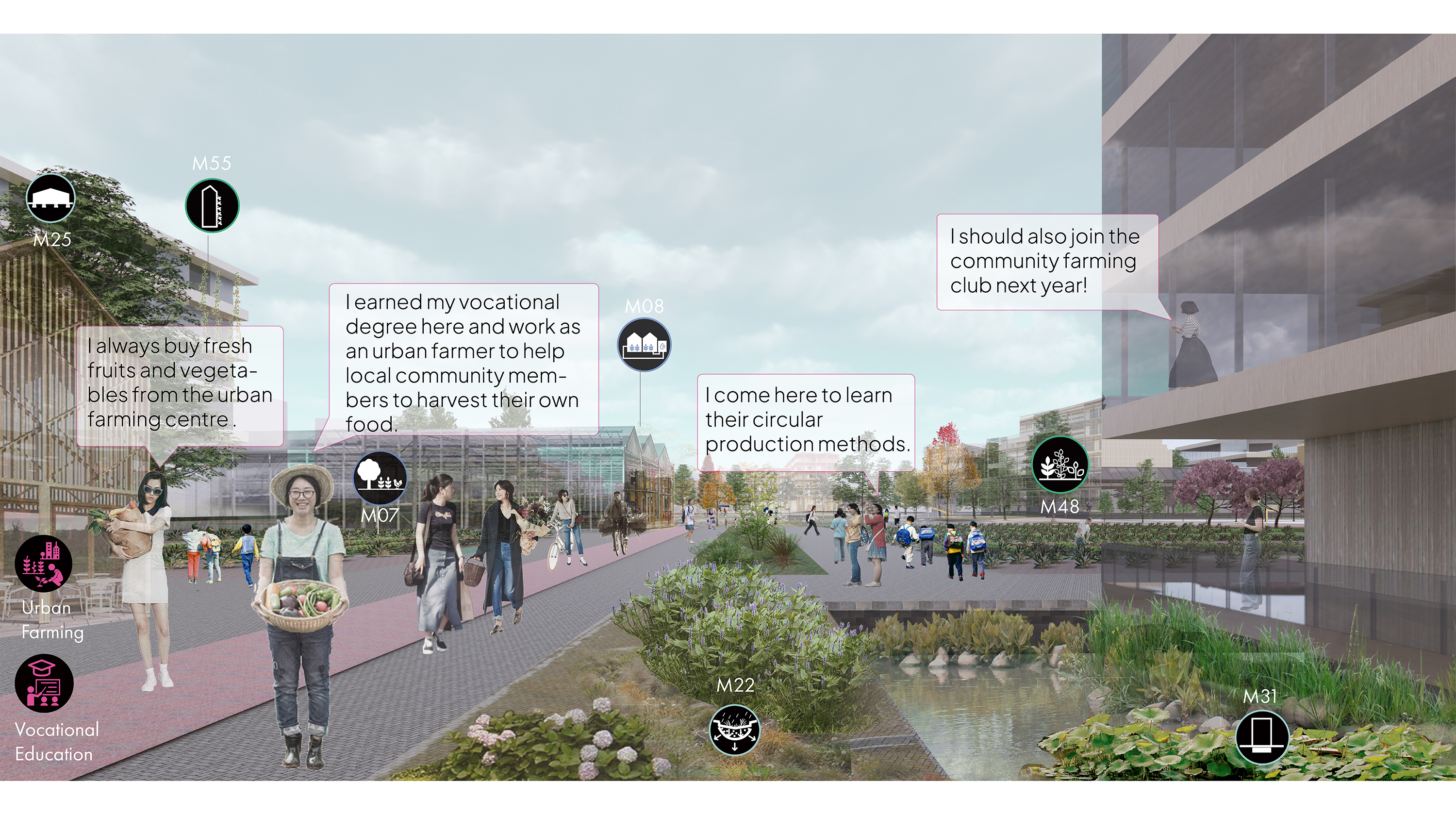
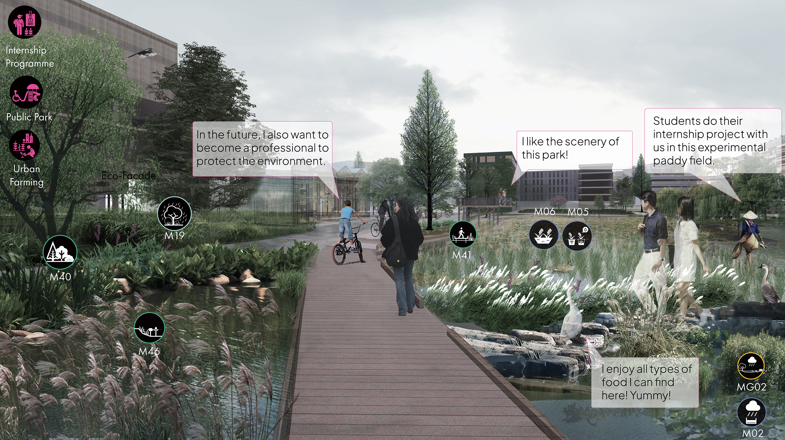
In the project, a pattern language method is employed (Click here to explore the pattern language approach further), where a series of design solutions and new programmes are proposed on different scales. Based on this tool, a new vision of Shangpai Town, currently the frontier of the urbanisation of Lake Chao Basin, is developed to illustrate the implementation of the tool as well as serve as a showcase project for the whole region.
Vision
Vision Statement
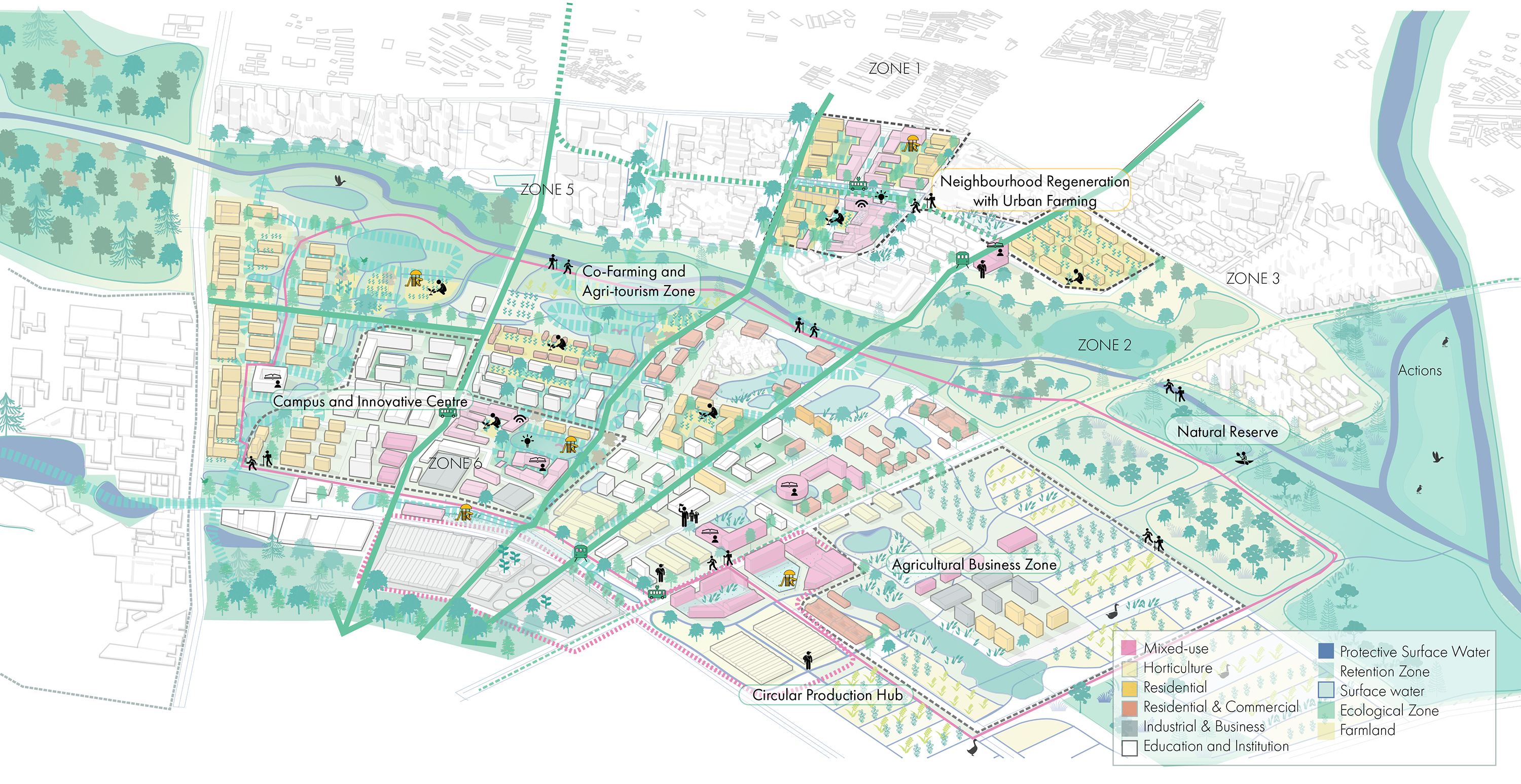
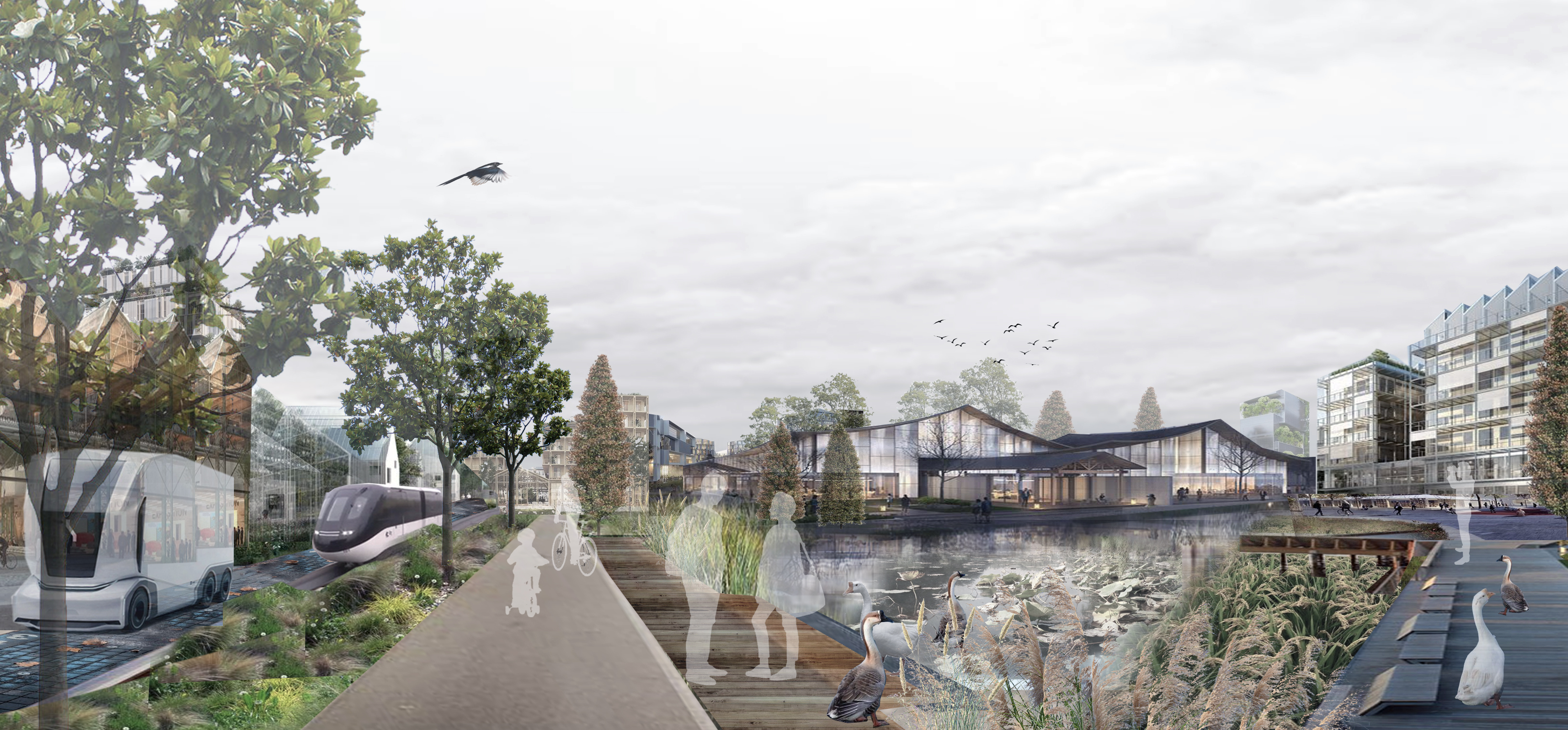
With the implementation of the water-oriented pattern language, the citizens in Shangpai Town can live with water in a sustainable way. The boundary between agricultural production, industrial zone and residential zone are blurred, so the water loop can be fully circular to minimize the freshwater consumption. The urban space is designed with the natural rainwater circle taken into full account, which makes sure that the citizens are fully protected from further flooding events. The ecosystem is also regenerated for the flourishment of the waterscape, with the polder agricultural zone, wetland zone and urban space interconnecting to form a dynamic ecological network. More importantly, the whole area will function as an educative park. By integrating all types of programmes into people s daily life and daily production, the mindset of people can be reoriented to appreciate a more sustainable relationship with water in the future.
Relinking Water and People in Built Environment
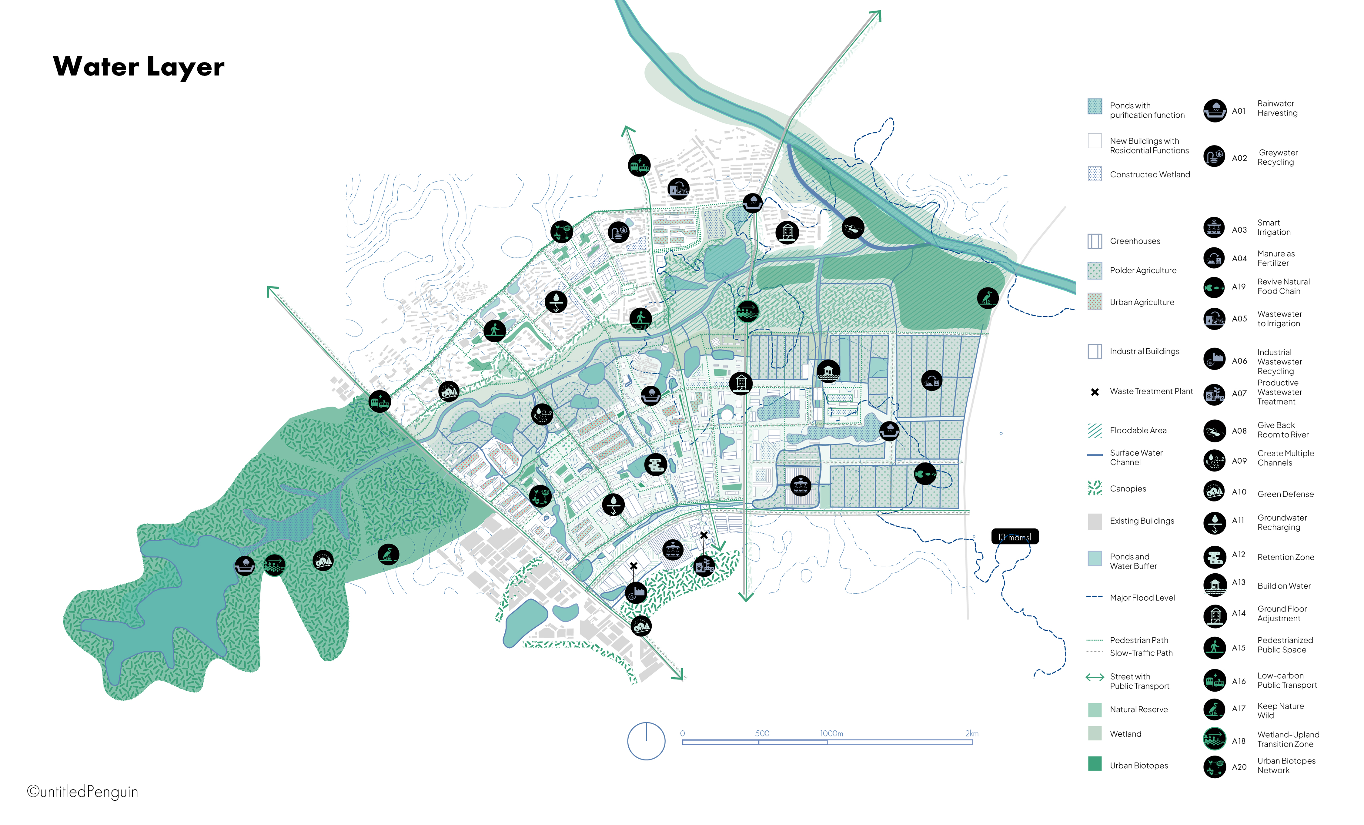
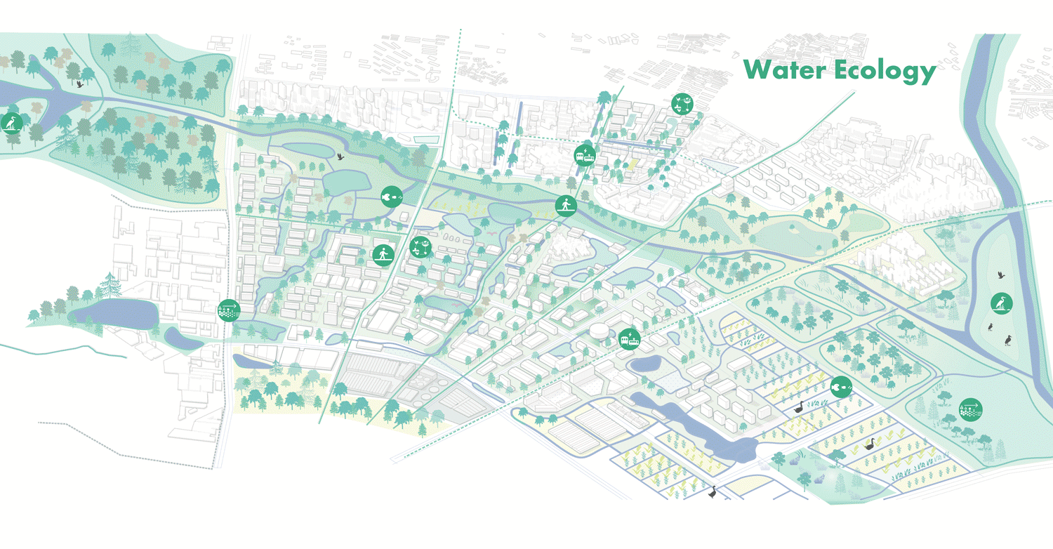
Embracing a Healthy Water System
Micro Scale Vision
The Possibility of Co-creation
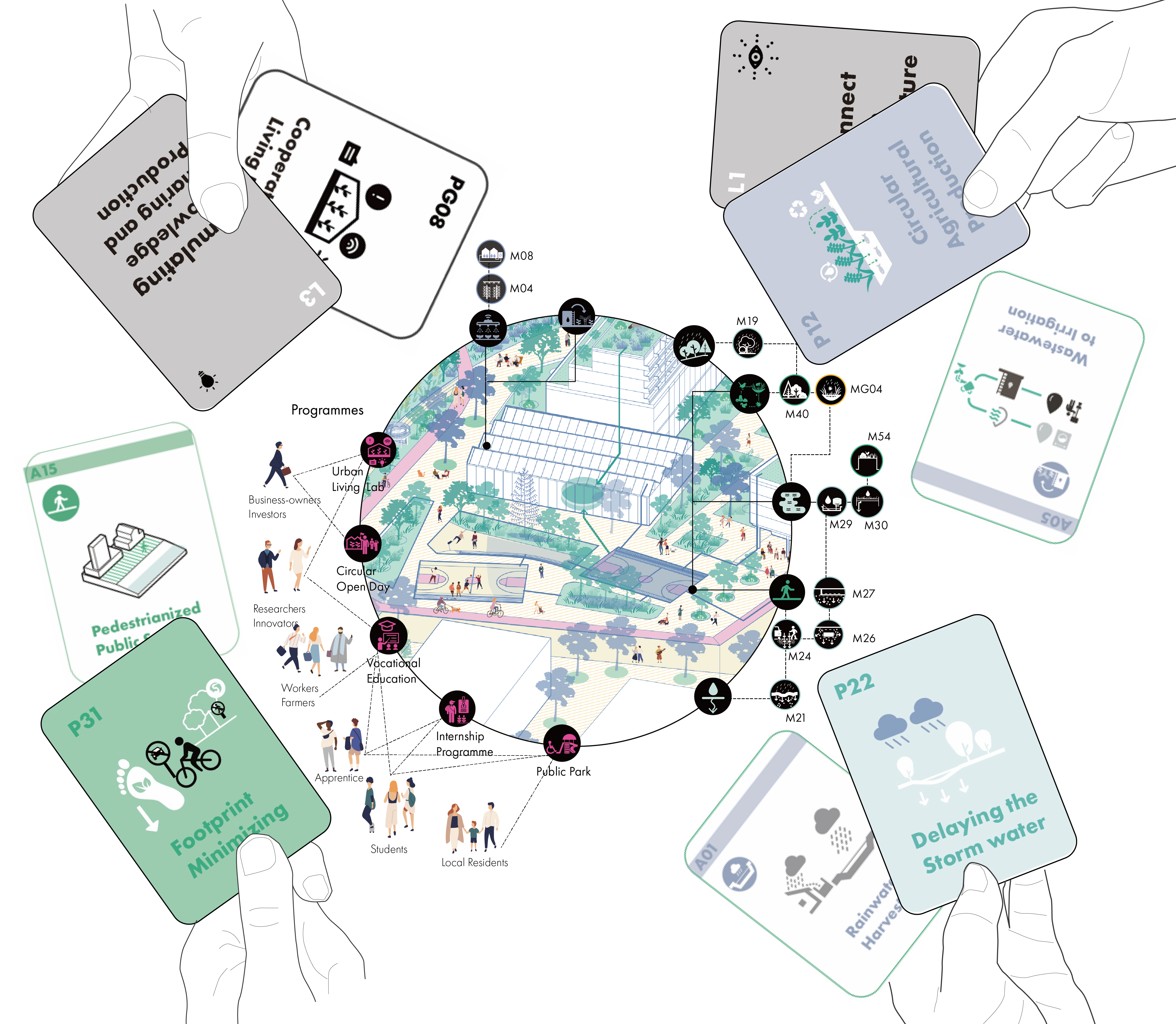
Community members can cocreate a water-oriented neighbourhood based on their preference using the pattern language like playing cards.
A Water-Oriented Neighbourhood
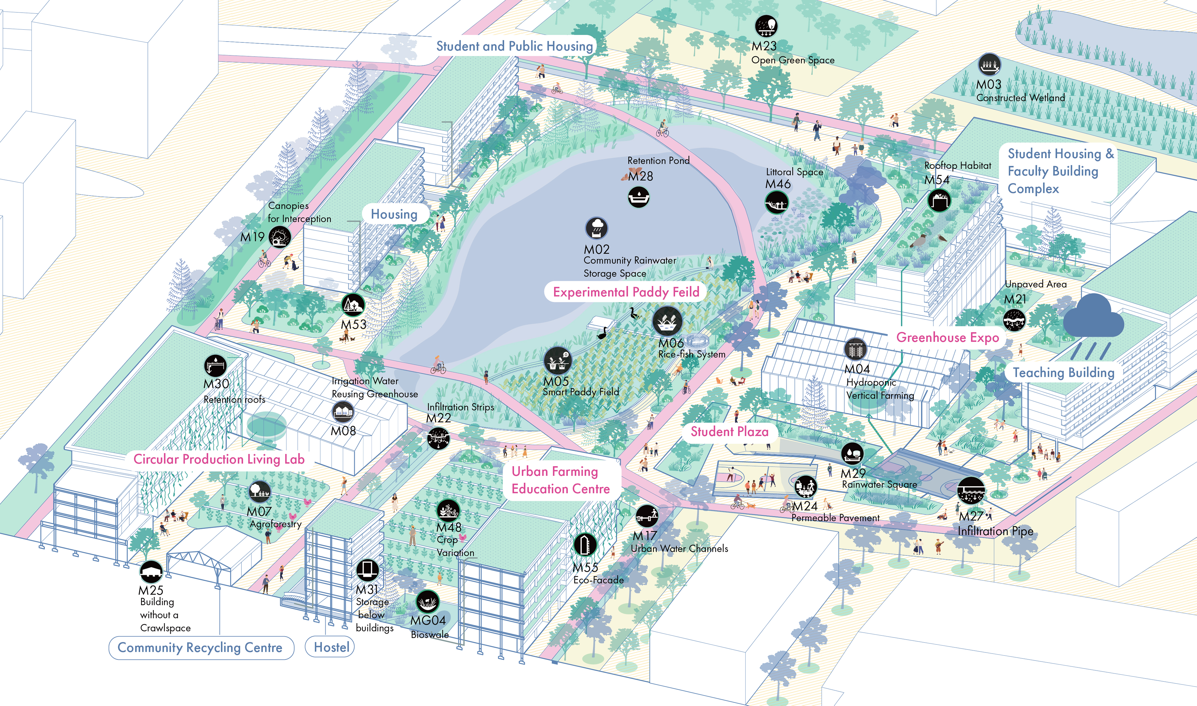
Rainwater Plaza
Community Co-farming Zone
Experimental Paddy Field Park
Acknowledgement
All the visualizations above are the creation of Jiaqi Wang. I would like to express my heartfelt appreciation to Kristel Aalber and Remon Rooij for their invaluable guidance throughout my graduation project.

Look forwards to getting in touch with you!
☕ Powered by github
based on Pudhina theme by Knhash 🛠️